Camera Networks for Weather Monitoring
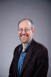
Jerry Brotzge
Western Kentucky University
Abstract
Historically, weather information was difficult to obtain; data were sparse and expensive, often collected manually only once per day at relatively isolated stations. Fortunately, twentieth-century advances in computing, telecommunications, and solar power spurred the development of automated weather networks (referred to as mesonets) which now collect multiple weather variables in near real-time, 24/7, across much of the U.S. Nevertheless, most of these networks are still limited to collecting in situ, quantitative data. However, recent improvements in camera quality, ruggedness, and cost now make cameras ideally suited for inclusion as a standard weather station sensor. As demonstrated by two large statewide mesonets (KY, NY), cameras provide a number of benefits for weather monitoring. These benefits include improved support for: 1) weather operations, 2) commercial applications, 3) data quality control, 4) site metadata, 5) site security, 6) research and 7) educational opportunities. This presentation will review the many benefits, some challenges, and the future of cameras as part of a weather observation network.
Biography
Dr. Jerry Brotzge serves as the State Climatologist of Kentucky, the Director of the Kentucky Climate Center (KCC), and Director of the Kentucky Mesonet. He also serves as Professor of Meteorology in the Department of Earth, Environmental and Atmospheric Sciences at Western Kentucky University. In these roles, Dr. Brotzge is collaborating with commercial, academic and public partners from across Kentucky to improve the collection, quality and application of environmental data. For example, his KCC research team is working with the agriculture, emergency management, health, and transportation sectors to improve their operations with more local, higher quality weather and climate data. Dr. Brotzge received a BS in Meteorology from Saint Louis University and MS and PhD in Meteorology from the University of Oklahoma.
Operational Implementation of Imagery in USGS Water Science
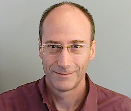
Jack Eggleston
USGS Hydrologic Remote Sensing Branch
Abstract
The USGS has undertaken a major effort to increase and enhance use of imagery in national hydrologic monitoring. The Water Mission Area and Water Science Centers have built unified enterprise systems for collecting, quality assuring, storing, and analyzing camera images. These national imagery data systems with associated standards and policies have reached operational status, are growing and developing, and are providing a foundation for new water science and new technical applications.
A fundamental guiding principle is to treat imagery as scientific data. This carries requirements for delivery of images to follow standard publishing and fundamental science practices, for imagery data go into long-term storage, and for imagery data to follow open science practices and be made available to the public.
Applications have been developed both internally and through funding agreements with external partners. Internal applications include the National Imagery Monitoring System (NIMS), the Hydrologic Imagery Visualization and Information System (HIVIS) online camera portal, the Flow Photo Explorer (FPE), the River Image Sensing (RISE) program to measure water levels, and others.
Biography
Dr. Eggleston is a hydrologist with the U.S. Geological Survey, and Chief of the Hydrologic Remote sensing Branch. His scientific expertise is in remote sensing, hydrologic modeling, and water resource management. Prior to joining the USGS in 2002, he was a research professor at Duke University and North Carolina State University. He has a PhD in Civil and Environmental Engineering from Duke University and a BA in mathematics and philosophy from St. John’s College.
WebCOOS: Delivering Data for Decisions
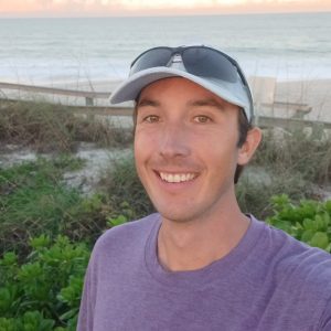
Theo Jass
SECOORA – Southeast Coastal Ocean Observing Regional Association
Abstract
WebCOOS (Webcam Coastal Observation System) is a network of web cameras deployed along the coast to make high-impact observations at a low cost. Starting in 2017 as the WebCAT pilot project with a small number of sites in the coastal southeast, this project has grown to include 20 sites not only in the southeast but also in California, Hawaii, Michigan, and Texas. The newest phase of the project will expand this network across the IOOS Regional Associations and add 60 cameras over three years from the Pacific Islands to Maine, to Alaska and the Caribbean.
Project PIs at University of South Carolina, University of North Carolina Wilmington, University of California Santa Cruz, NOAA CO-OPS, and Axiom Data Science have worked to develop and integrate algorithms for a number of coastal applications. These include rip current detection, beach erosion and shoreline change, beach usage and object detection, and flood monitoring. These algorithms are being integrated into camera streams to create products in near real time. As the project expands nationally, we are working in partnership with each IOOS RA to select locations and applications of interest for the coastal scientific and management communities.
Biography
As the WebCOOS Project Manager with SECOORA, Theo leads SECOORA’s WebCOOS project in collecting webcam imagery and developing derived products for coastal observation. With collaborators at University of North Carolina Wilmington, University of South Carolina, University of California Santa Cruz, NOAA, and Axiom Data Science, he is working to expand this observing network nationally in partnership with the other IOOS Regional Associations.
Theo has a M.S. in Geological Sciences from the University of North Carolina at Chapel Hill, and his thesis focused on coastal geomorphology and dune ecosystems. He was an ORISE Research Participant at EPA-GLNPO from 2020 to 2022, and he received a Wade Family Scholarship for summer study in marine ecology at the Duke Marine Laboratory in 2007. Theo has also worked as an Environmental Scientist in ecohydrology and watershed science at NC State University.
Leveraging USGS HIVIS to Remotely Monitor Streamflow Conditions in the US
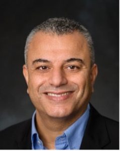
Marouane Temimi
Stevens Institute of Technology
Abstract
Routine streamflow observations at USGS stations are collected using standard methods that usually involve stage readings and site-specific rating curves. Meanwhile, several USGS stations are equipped with cameras that have an inherent potential to extract valuable information on the river’s hydraulic conditions. The goal of this project is to develop a computer vision-based system to automatically measure streamflow, and water level, and determine river flow conditions by leveraging the USGS Hydrologic Imagery Visualization and Information System (HIVIS). First, the work covers the preprocessing of the raw images to prepare them for integration in the imagery system to infer streamflow, which includes filtering out potential sources of interferences like glare, shade, fog, and rainfall. Deep learning-based techniques are tested for segmentation. In this project, the development of a novel method for the processing of HIVIS images to mitigate the impact of interfering factors and maximize their use to monitor flow conditions will be achieved. Eventually, we will work on integrating the developed methods into automated, robust, and scalable velocimetry methods like LSPIV for continuous measurement of streamflow. The development of a new system to measure streamflow using HIVIS data will certainly enhance the nation’s capabilities to monitor flood hazards, assess their risk, and protect people and properties.
Biography
Dr. Temimi is an Associate Professor in the Civil, Environmental, and Ocean Engineering Department at Stevens Institute of Technology, in New Jersey, USA. Dr. Temimi obtained his Ph.D. degree in water resources and remote sensing and his MSc degree in Hydrology from the University of Quebec, Montreal, Canada.
He led/co-led several research projects including those funded by NOAA and NASA. Dr. Temimi holds an international research experience with applications in Canada, Europe, and the Middle East. Dr. Temimi is active in the field of hydrometeorology. He uses numerical models and satellite imagery extensively to simulate hydrological processes and extreme weather events.
Dr. Temimi founded the Integrated Spatial Modeling and Remote Sensing Technologies Laboratory (I-SMART), an interdisciplinary research unit within the Davidson Laboratory at Stevens Institute of Technology in New Jersey, USA. He taught several courses in water resources, remote sensing, and GIS. He mentored more than 30 graduate and undergraduate students. He has more than 100 peer-reviewed publications and several contributions to books and book chapters. Dr. Temimi holds relevant industrial experience in water resources with major engineering firms.
GRIME-AI: Open-source Software for Ecohydrological Science and Education using Ground-based Time-lapse Imagery
Troy Gilmore
University of Nebraska – Lincoln
Abstract
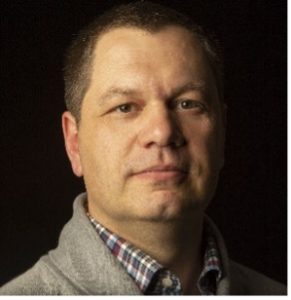
Ground-based time-lapse imagery contains untapped qualitative and quantitative information. Imagery can replace, complement, or extend monitoring capabilities of other traditional sensors. This potential is highlighted by the growing imagery archives of large and small time-lapse camera networks and repositories, in addition to many short-term projects that rely on a small number of cameras. There are challenges to the multi-disciplinary task of using ground-based imagery archives, however. Acquisition and fusion of imagery and other sensor data from public archives, selecting subsets of data for desired time periods, image triage (data cleaning through removal of low-information images), image processing, and model development are example tasks that can impede progress toward scientific outcomes. GaugeCam Remote Image Manager Educational – Artificial Intelligence (GRIME-AI) is a Windows application being built to streamline these tasks, with the goal of enabling a broader range of end users to leverage their disciplinary knowledge and creativity and to advance scientific discovery through use of imagery. This talk will focus on the development and current status of GRIME-AI software. GRIME-AI is open-source software released under Apache 2.0 license.
Biography
Troy is an Associate Professor in the Conservation and Survey Division (Nebraska’s Geological Survey) in the School of Natural Resources and is associated with the Biological Systems Engineering Department at the University of Nebraska – Lincoln. Troy’s educational background is in Civil Engineering (BS) and Biological and Agricultural Engineering (PhD) and he is currently enrolled in the University of Nebraska at Omaha Data Science MS program. His research includes groundwater hydrology, groundwater-surface water interactions, water quality, and innovative monitoring methods. The original GaugeCam Remote Image Manager Educational (GRIME) software, dedicated to water level measurement with cameras, was developed during his undergraduate research under François Birgand at North Carolina State University.
Operationalizing Remote Measurements of Streamflow with Fixed and Mobile Camera Platforms
Frank L. Engel
U.S. Geological Survey – WMA Hydrologic Remote Sensing Branch
Abstract
The U.S. Geological Survey (USGS) is actively promoting the use of non-contact methods for determining streamflow with cameras. Recently, the USGS has made significant progress in developing methods and software to support this approach. In this presentation, I will provide an overview of the non-contact hydrology methods and approaches currently in use. I will also demonstrate the latest software products developed by USGS scientists to process this data consistently and conveniently. Finally, I will discuss the future direction of non-contact streamflow applications within the survey and explore ways to collaborate with other scientists to advance this field.
Biography
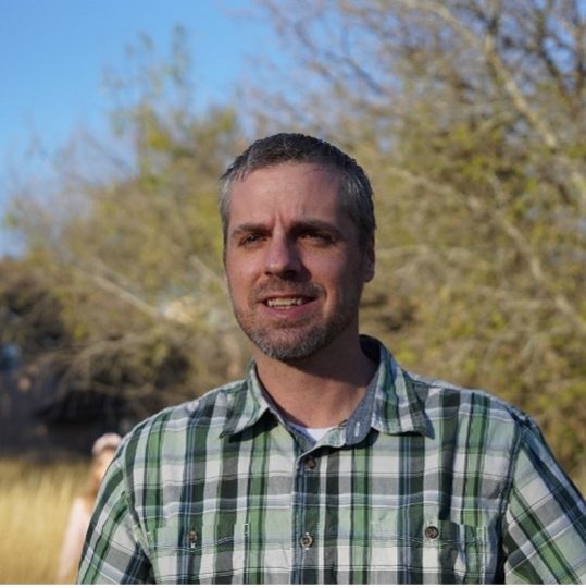
Dr. Frank Engel is a Geographer with the U.S. Geological Survey (USGS), specializing in implementing cutting-edge research applications into operational science. Trained initially as a fluvial geomorphologist, Frank now conducts research to advance non-contact measurements of riverine parameters so that they can be operationalized in the USGS for day-to-day gaging and project applications to solve real-world problems. Dr. Engel is working to create enterprise-level cyberinfrastructure for cameras and multispectral sensors located at gaging stations throughout the USGS. Frank lives in San Antonio, TX, with his wife and two kids and enjoys gravel biking, hiking, and the outdoors in general.
Hydrologic Monitoring using Cameras: Key Takeaways from Initial Deployments
Sierra Young
Utah State University
Abstract
Camera-based monitoring systems have enormous—yet largely untapped—potential to collect continuous observations for water infrastructure and hydrologic monitoring by extracting measurements from imagery and video, such as surface velocity and water level. Noncontact optical measurement systems can complement and, in some cases, replace conventional sensing technology. While computer vision methods can provide promising and accurate results, practical barriers exist to the widespread implementation and operationalization of optical stream gauging. To help address this, deep learning methods have emerged as a promising method to segment water from other objects in images under varying conditions, thus making optical gauging methods more generalizable. This talk will demonstrate progress in our first year of a three-year project to evaluate how deep learning image processing methods and cloud computing can be deployed with low-cost RGB imaging systems in the field for monitoring water infrastructure and discuss some of the operational challenges associated with deploying these systems and analyzing data at new locations.
Biography
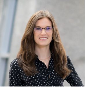
Sierra Young is an Assistant Professor in the Civil and Environmental Engineering Department and the Utah Water Research Laboratory at Utah State University. Broadly speaking, her research focuses on the use and development of electronics, computer vision/AI, robotics, and automation for sensing and sense-making in environmental systems. Through developing and deploying these technologies, work conducted in her lab aims to improve our ability to monitor and understand complex environmental processes. Prior to joining Utah State, Dr. Young was an Assistant Professor in the Department of Biological and Agricultural Engineering at North Carolina State University. She was previously awarded the New Faces of ASABE Top Honoree and was recently invited to participate in the 2021 National Academy of Engineering US Frontiers of Engineering (FOE) Symposium. Dr. Young received her Ph.D. in Civil Engineering as a Department of Defense NDSEG Fellow from the University of Illinois at Urbana-Champaign in 2018.
Advancements in Water Observing Technology: From Dataset Development to Deep Learning Applications
Erfan Goharian
University of South Carolina
Abstract
Our research endeavors to address critical challenges in water observation technology through comprehensive dataset creation, smart camera system development, and AI-based image processing tools. Firstly, we introduce ATLANTIS, a benchmark dataset comprising over 5,000 annotated images across 56 classes related to waterbodies and surroundings. Additionally, we present ATeX, a dataset emphasizing diverse water textures, evaluating deep learning models for classification tasks, highlighting the efficacy of CNN networks and the potential of ATeX as a benchmark in water domain image analysis. Secondly, we showcase the development of two affordable smart camera systems, Beena and Beena-light, utilizing Raspberry Pi and drone-deployable water level sensors, Arduino, enabling real-time data collection and image processing. These systems facilitate rich dataset creation for real-time monitoring and semantic segmentation, enhancing model validation and utilization. Lastly, we demonstrate the practical applications of AI-based image processing in water level measurement and flood inundation detection. AquaNET, our exclusive water detection network trained on ATLANTIS, and SegFormer, a deep learning framework integrating surveillance cameras for semantic segmentation, exhibit remarkable accuracy in estimating water depth and hydrograph changes compared to traditional methods. Our framework, Eye of Horus, provides a vision-based solution for real-time water level measurement, showcasing efficiency and accuracy in hydrologic measurement tasks.
Biography
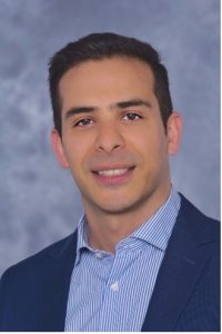
Erfan Goharian is the CEC Distinguished Associate Professor in Water Resources Engineering at the University of South Carolina (USC). Leading the interdisciplinary research group iWERS, Dr. Goharian focuses on addressing critical challenges in water observation technology and smart water management. His work emphasizes the development and deployment of innovative Artificial Intelligence (AI) and systems engineering techniques to enhance the informed operation of integrated civil and water resources systems, particularly in response to climate change and extreme events like floods and droughts.
His research has garnered significant funding from national programs including NSF, NOAA, USGS, and DOD, as well as from state agencies and tech companies. With over 60 peer-reviewed journal papers and prestigious awards like the NSF Early CAREER Award and UCOWR Early Career Award in Applied Research.
Creating an Educational Pathway for Autonomous Technology Innovators
David Young
RoboNation, Inc.
Abstract
In this presentation, we explore the introduction and use of sensor technology in the secondary education level promoting citizen science and emphasizing its role in monitoring water quality and environmental parameters. RoboNation’s GoSense sensor program provides educators and students with a platform to participate and collaborate in scientific research. Sensors in this field allow students and community members to collect, analyze, and share water quality data, offering a practical and hands-on approach to environmental monitoring.
The core of the presentation highlights the impact of using sensor technology in educational settings. Sensors bridge the gap between theoretical knowledge and real-world application by engaging students in the data collection process. Students are given the opportunity to engage in hands-on experiences that enhance their understanding of environmental science as well as foster a sense of connection to their local ecosystems.
Furthermore, the presentation will explore the broader implications of citizen science initiatives based on sensors including RoboNation’s higher level autonomous vehicle competitions. These competitions provide a pathway for students to learn and apply autonomous technology in aerial, marine, and underwater environments.
Attendees will gain insights into the practical aspects of implementing sensor technology in educational and community-based projects, including challenges, best practices, and success stories. The presentation seeks to inspire forum attendees to take intentional steps to engage with organizations and students to promote STEM education and solve real-world challenges.
Biography
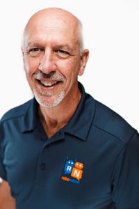
David Young is the Product Manager at RoboNation managing the SeaPerch and SeaGlide educational kits. David has worked at RoboNation for six years. His role extends beyond product management into product development. David works to broaden and deepen RoboNation’s product portfolio. His product development work and building gadgets has earned him the nickname “Master Tinkerer”.
David also serves as the Technical Director of the International SeaPerch Challenge, responsible for the design of competition courses and pool operations. His background includes over 35 years at the U.S. Naval Research Laboratory (NRL), where he worked in a range of fields from design engineering and precision fabrication of scientific instrumentation to software development. While with NRL David worked in schools on the Mississippi to expand the SeaPerch program and provided technical direction for the Gulf Coast Regional SeaPerch Challenge. His work with the SeaPerch program laid the groundwork for his transition to RoboNation post-retirement.
David describes his current role as one of the most enjoyable jobs imaginable. Now residing in Houston, Texas, he enjoys being closer to his family, including his grown children and grandchildren. His grandchildren love participating in STEM experiments in David’s mad scientist lab/office.
The Global Drifter Program: Observations of the Global Air-Sea Interface with Surface Drifting Buoys
Luca Raffaele Centurioni
Lagrangian Drifter Laboratory, Scripps Institution of Oceanography, University of California San Diego
Abstract
One of the main goals of the Global Drifter Program (GDP) is to maintain a global array of satellite tracked surface Lagrangian drifters. The GDP is the largest component of the Global Surface Drifting Buoy Array, a branch of NOAA’s Global Ocean Observing System (GOOS). The GDP is also a scientific project of the Data Buoy Cooperation Panel (DBCP) of the World Meteorological Organization.
In the most common configurations, GDP drifters measure essential climate variables (ECV) such as sea surface temperature (SST), sea level atmospheric pressure (SLP), the truncated directional spectra of surface gravity waves and near-surface ocean currents. The data collected by the GDP drifters are shared in near real-time for data assimilation purposes through the Global Telecommunication System. Several curated and quality controlled GDP datasets are also publicly available following the FAIR-O principles.
The most studied beneficial impacts of the drifter data are related to the calibration and validation of remotely sensed SST, to the assimilation of drifter-derived SLP data in numerical weather prediction (NWP) models and to the publication of over 1,000 scientific articles that use GDP data. Furthermore, SLP data from drifters are known to improve the calculation of the inverse barometer effect, used to correct sea-level data, and of several climate indices.
In recent years, new scientific research needs resulted in the creation of more capable drifters that can measure the near-surface horizontal wind, the directional wave spectra, the surface salinity and the optical backscatter coefficient, among other variables. Recent examples of applications of these new drifters and their potential to sustain an enhanced global drifter network at the air-sea interface will be discussed.
Biography
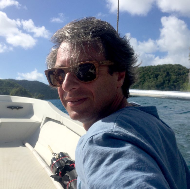
Dr. Luca R. Centurioni is the director of the Lagrangian Drifter Laboratory and Principal Investigator of the NOAA funded Global Drifter Program (GDP), a global array of surface drifters delivering real-time oceanographic and meteorological observations.
Dr. Centurioni is also a research oceanographer, lecturer and CIMEAS fellow at the Scripps Institution of Oceanography where he conducts scientific research and advises graduate students and postdoctoral researchers.
Dr. Centurioni was a Research Fellow at HR Wallingford Ltd (1992-1995), received his PhD (2000) in physical oceanography from the Southampton Oceanography Centre (SOC, U.K.) and was a Postdoctoral Research Assistant at the James Rennel Division (SOC, 1999-2002) before moving to Scripps in 2002.
At Scripps, Dr. Centurioni joined the GDP in 2002 before becoming the Principal Investigator of the project in 2010.
He is a member the Data Buoy Cooperation Panel (DBCP) of the World Meteorological Organization and of the Intergovernmental Oceanographic Commission.
Dr. Centurioni ‘s Lagrangian Drifter Laboratory provides about 1,000 drifter/year and designs new sensors and instruments for the collection of oceanographic and meteorological data in the world’s ocean, including in the path of tropical storms. He has authored or coauthored more than 100 peer-reviewed articles in major scientific journals
Uncrewed Surface Vehicle for Autonomous Hypoxia Monitoring
Stephan Howden
The University of Southern Mississippi
Abstract
A public-private partnership, led by the University of Southern Mississippi with the Gulf of Mexico Coastal Ocean Observing System (GCOOS), Integral Consulting, and L3Harris/ASV, has been funded by the National Oceanic and Atmospheric Administration’s Integrated Ocean Observing System as an Ocean Technology Transition Project, to accelerate the transition of adaptive, autonomous water quality profiling capabilities for a work-class uncrewed surface vehicle (USV), to collect water quality parameters, including dissolved oxygen, down to within a meter of the seafloor, and develop a framework for transitioning the technology to operations. The vessel is an L3Harris C-Worker 5 work-class USV. The project has demonstrated: 1) The ability of the USV to profile with a water quality package in stratified waters of the northern Gulf of Mexico, in depths from 5 m to over 50 m, to include observations to within 1 m of the sediment bed; 2) Development and operation of a real-time data management system that includes near-real-time telemetry of profiles of data relevant to hypoxia monitoring, automated quality control flags that are included in the metadata, and serving of data on the GCOOS Data Portal. The focus of the transition to operations will be on characterization of Northern Gulf of Mexico hypoxia events to support northern Gulf of Mexico hypoxic zone surveys and modeling. Results from the offshore demonstration in 2022 and the offshore mapping demonstration of 2023 will be presented, and the ongoing development of the transition plan will be discussed.
Biography
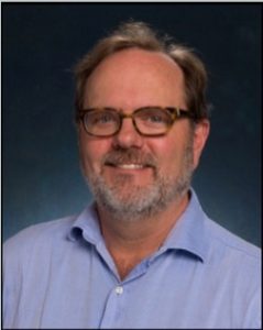
Stephan Howden currently serves as Director of the Hydrographic Science Research Center (HSRC), which provides research support to address the needs of governmental and commercial clients for information related to coastal and ocean navigation, the ocean floor and ocean processes. He also is a professor on the faculty of the School of Ocean Science and Engineering at the University of Southern Mississippi. He joined the faculty of USM in 2000, teaching in the Hydrographic Science MS program, which is one of only two in North America recognized at the Category-A level by the International Board on Standards of Competence for Hydrographic Surveyors and Cartographers, of the International Hydrographic Organization, the International Federation of Surveyors, and the International Cartographic Association. His research focuses on interdisciplinary coastal and oceanographic studies from a physical oceanography perspective, and the intersection of physical oceanography and hydrographic science. Since its inception in 2004, he has directed the Central Gulf of Mexico Ocean Observing System (CenGOOS), which operates under the umbrella of the Gulf of Mexico Coastal Ocean Observing System (GCOOS) and the NOAA Integrated Ocean Observing System. CenGOOS operates a met-ocean/ocean acidification buoy, a network of 6 High Frequency Radar stations, and buoyancy gliders. Since 2010 he has served as an elected member of the Board of Directors of GCOOS. He holds a B.S. in Physics from the University of Buffalo, a M.S. in Physics from Michigan State University, and a Ph.D. in Oceanography from the University of Rhode Island.
Autonomous distributed measurement for water quality estimation using mobile sensor networks
Herbert (Bert) Tanner
University of Delaware
Abstract
Marine sensing and automation technology is reaching a maturity point where the automated deployment and management of distributed, reconfigurable sensor networks becomes affordable and practical. While significant scientific and technology barriers in the marine robotic sensor networks domain persist, this talk will highlight the enormous benefits that such networks can provide when used for data collection, sensor fusion, and environmental parameter estimation. Using salinity measurement and estimation as a use case, we will demonstrate how certain deployment strategies that couple sensor placement coordination with data filtering and estimation can yield robust and precise estimates of scalar environmental quantities, providing savings in mission time, costs, and needs for human operator involvement.
Biography
Bert Tanner received his Ph.D. in mechanical engineering from the NTUA, Athens, Greece, in 2001. He was a postdoctoral researcher at the University of Pennsylvania from 2001 to 2003, and subsequently took a position as an assistant professor at the University of New Mexico. In 2008 he joined the Department of Mechanical Engineering at the University of Delaware, where he is currently a professor. In 2019 he was appointed Director of the Center for Autonomous and Robotics Systems. Tanner’s research interests range from multi-robot system planning and control, flocking and swarming, constrained navigation, heterogeneous agent coordination, and hybrid systems, with application domains that span a diverse range from radiation detection, to pediatric rehabilitation and marine robotics. He received NSF’s Career award in 2005, he is a fellow of the ASME, and a senior member of IEEE. He has served in the editorial boards of the IEEE Transactions on Automatic Control, the IEEE Robotics and Automation Magazine and the IEEE Transactions on Automation Science and Engineering. He is currently an associate editor for the IFAC’s journals Automatica and Nonlinear Analysis Hybrid Systems, and he is a chief specialty editor for Frontiers in Robotics and AI: multi-robot systems. He has also been serving in several conference editorial boards of both IEEE Control Systems and IEEE Robotics and Automation Societies.
Monitoring South Florida’s Coastal Ecosystems: Protecting our Health, Wealth and Happiness
Dr. Todd A. Crowl
Institute of Environment, Florida International University
Abstract
As temperatures continue to increase, rainfall patterns change and coastal population density continuous to grow, coastlines, such as South Florida, are experiencing increasing threats from sea-level rise, extreme temperatures and nutrient pollution. Assessing current biophysical and chemical characteristics of coastal ecosystems such as Biscayne Bay in South Florida in near real-time and large spatial scales is now necessary to provide early warning systems to stakeholders and policymakers and to provide better predictive and mechanistic models to alter our current water management and infrastructure policies. To achieve this, FIU Institute of Environment Scientists are designing and constructing an array of networked stationary and mobile platforms configured to transmit real-time data characterizing water quality, animal distribution, and other parameters across critical habitats of Biscayne Bay that will serve to inform both research and academic as well as outreach objectives. We propose to advance developments in algorithm design and new sensor technology to improve the timeliness and precision of these data to identify gradients in physical chemical properties to serve as an early warning system to identify potential tipping points leading to changing patterns in the biological community. We are compiling assets which include several SeaRobotics autonomous surface vehicles, YSI Ecomapper underwater autonomous vehicle, an array of networked water quality buoy stations, in addition to a suite of other autonomous systems, including aerial drone systems. Our state-of-the-art federally funded motion capture testbed will be used to speed up development in autonomy by providing a scaled ecosystem to test and implement sampling strategies for autonomous platforms.
Biography
Dr. Todd A. Crowl is an ecologist with more than 35 years of experience working on interdisciplinary projects related to ecosystems science and aquatic ecology. He has been a Senior Scientist in the Luquillo LTER Program located in Puerto Rico since 1994. The LUQ LTER is part of a national network of sites designed to understand long-term dynamics of important global ecosystems. From 2009-2011, he directed the Long-Term Ecological Research Program (LTER) for the National Science Foundation (NSF). In 2012, he was awarded a $20 million grant to establish iUTAH, a statewide effort to assist in building the human and research infrastructure needed to sustainably manage Utah’s waters through the NSF EPSCoR Program. Most recently, he and FIU collaborators have received $10 million from NSF for the Center of Research Excellence in Science and Technology (CREST) for Aquatic Chemistry and the Environment. Crowl was a Bullard Fellow at Harvard University and an Office of Research Professor at the University of Notre Dame. Crowl is the Founding Director of Florida International University’s Institute of Environment, an FIU Pre-eminent Program (environment.fiu.edu) that includes more than 150 faculty that provide fundamental and applied research on freshwater, coastal and terrestrial ecosystems. In 2023, Crowl and colleagues received a $9.5 million award from NIST to design and build a Robotics and Autonomous Vehicle Systems Center to advance the development and use of Drone technology for environmental problem solving. Crowl is the past President of the Association of Ecosystem Research Centers and is on the Board of Directors for the American Institute of Biological Sciences, The Southeastern Universities Research Association and the Biscayne Bay Watershed Management Advisory Board.
Integrating Acoustic Communications with Underwater Autonomy
Aijun Song
The University of Alabama
Abstract
Autonomous underwater vehicles (AUVs) offer a promising avenue for the evolution of next-generation technology in adaptive water sampling. Their cost-effectiveness in field operations and efficient data collection capabilities present distinct advantages over conventional ship-based methods. Particularly compelling is their potential to form a coordinated fleet capable of executing joint underwater missions, commonly referred to as underwater swarming. However, one of the primary challenges in underwater swarming revolves around the difficulties associated with acoustic communications. Wireless communication is crucial for robot localization, vehicle coordination, and formation control. Acoustic communications is the primary method for underwater telemetry. Unfortunately, due to the dynamic nature of aquatic environments, acoustic waves can only support limited data rates with unstable link performance. Our research addresses the need for an improved understanding of how acoustic communications impact underwater swarming. In this presentation, we introduce two efforts: 1) a software environment for underwater communication-autonomy simulations and 2) hardware integration of acoustic modems on AUVs. We show how communication delay affects vehicle navigation and fleet formation with software simulations. We will also show our progress in the hardware integration and field test results.
Biography
Aijun Song is an Associate Professor with the Department of Electrical and Computer Engineering at the University of Alabama, Tuscaloosa, AL, USA. He received a Ph.D. in electrical engineering from the University of Delaware, Newark, DE, USA 2005. From 2005 to 2008, he was a Postdoctoral Research Associate with the College of Earth, Ocean, and Environment, University of Delaware. During this period, he was also an Office of Naval Research (ONR) Postdoctoral Fellow, supported by the Special Research Award in the ONR Ocean Acoustics program. He was a Research Professor at the University of Delaware from 2008 to 2015. Dr. Song’s research interests include underwater wireless communications and networking, underwater robotics, community-shared open infrastructure for underwater applications, and integrated communications, navigation, and sensing.
He is a recipient of the NSF CAREER Award (2021). He is the Associate Editor of the Journal of Acoustical Society of America.
USACE ERDC Uncrewed Survey System Development
Ian Conery
U.S. Army Corps of Engineers, Engineer Research and Development Center (ERDC)
Abstract
Bathymetric data is a critical component for effective management of USACE Civil Works coastal projects, yet monitoring in the nearshore region is often spatio-temporally sparse due to cost limitations and the hazardous nature of working with vessels in the surfzone with breaking waves and currents. To enhance safety and data availability, researchers at the USACE ERDC-FRF (Field Research Facility) have been exploring the use of and developing various autonomous platforms for a shallow-water and surfzone survey applications. The team has partnered with USACE District practitioners to better understand how existing survey programs could potentially benefit from autonomous systems. The fleet of platforms includes an amphibious uncrewed ground vehicle (AUGV) (Bayonet Ocean Vehicles), a self-righting autonomous surface vessel called the Yellowfin (Integrated Coastal Solutions) and a multi-vehicle collaborative fleet of micro–Autonomous Surface Vehicles (micro-ASVs) (Jaia Robotics). This work aims to evaluate survey accuracy and repeatability through a range of environmental conditions by comparing the systems measurements to known benchmarks at the FRF (e.g., Lighter Amphibious Resupply Cargo-LARC or acoustic altimeters) through different surveys during bi-monthly field deployments. In addition, this effort focuses on the assessment of various GNSS receivers for size, weight, power, and cost (SWaP-C) and design/integration of single beam sonar to the JAIAbot micro-ASV. Future work will focus on software development to enhance efficiency on mission planning, data quality, and safe return of the uncrewed assets. Ultimately, the team aims to make equipment, software, and concept of operations recommendations to the coastal practitioner community including our USACE Districts.
Biography
Ian Conery earned a Ph.D. in Coastal Resources Management from East Carolina University in 2019. Since joining the FRF full time in June 2019, Conery has worked on the FRF sediment beach and offshore sampling and laboratory analysis program, and the citizen science imagery project, CoastSnap (Co-PI). As a member of the remote sensing team, he has specialized in coastal morphodynamics and helped to lead the extensive regional mobile lidar collection, develop technology and workflows, and serve data to other users. Conery serves as PI for the satellite shoreline district tool project, PI for Engineering With Nature radar monitoring of floating vegetated mats for coastal protection, PI for a joint effort with ECU Coastal Studies Institute focusing on radar analysis in the Outer Banks, NC, and PI for Shallow water autonomous coupled survey systems (SWACSS). Conery has extensive experience in field operations and surveying (e.g., RTK-GPS, lidar, UAS, LARC). He has published as lead author in several international journals, along with multiple co-authorships and presentations at international conferences.
Autonomous Power Distribution System for Underwater Vehicles
Nina Mahmoudian
Purdue University
Abstract
The success of long-term marine network missions is measured by the ability of the autonomous systems to operate, for an extended period, in highly dynamic and potentially hazardous environments. There is an urgent need for universal undersea power distribution systems that lower deployment and operating costs while simultaneously increasing network efficiency and response in dynamic and often dangerous physical conditions. This talk presents the efforts to address the following technology problems as it translates from research discovery toward commercial application: inflated energy use currently required when the autonomous vehicles break from mission to return to recharging station; lack of multi-robot coordination needed to consider both fundamental hardware and network science challenges necessary to respond to energy needs and dynamic environment conditions. By addressing these gaps in technology, this work establishes the theoretical, computational, and experimental foundation for autonomous power delivery and onsite recharging capability for underwater vehicles.
Biography
Dr Nina Mahmoudian received the Ph.D. degree in aerospace engineering from Virginia Tech, Blacksburg, VA, USA, in 2009. She is currently an Associate Professor and B.F.S. Schafer Scholar with the School of Mechanical Engineering at Purdue University. She has expertise in autonomous systems, energy autonomy, system design, dynamics, and controls. Her research work lies at the intersection of system design and real-time control of maritime systems. Dr. Mahmoudian is a recipient of the 2015 NSF CAREER and 2015 ONR YIP awards and 2023-2024 Fulbright Scholar award.
Recent Development and Operation of CO-OPS’ Real-Time, Shallow Water CURrents BuoY (CURBY)
Laura Fiorentino
NOAA Center for Operational Products and Services (CO-OPS)
Abstract
The National Oceanic and Atmospheric Administration (NOAA) National Ocean Service (NOS) Center for Operational Oceanographic Products and Services (CO-OPS) manages the National Current Observation Program (NCOP) and Physical Oceanographic Real-Time Systems (PORTSⓇ). These programs provide tide and current predictions, as well as real-time measurements of currents, water temperature and conductivity, and meteorological information. To address emerging needs of both programs, CO-OPS has developed a rapidly-deployable, near-surface oceanographic and meteorological observation platform, named the CURBY (CURrents BuoY).
Initially field-tested and subsequently utilized in multiple NCOP tidal current surveys, CURBY’s measurements have been used to develop a variety of analysis products. Following initial successes with operational use across NCOP current survey operations, CO-OPS developed and delivered two new CURBY systems to the Gulf of Mexico region to support NOAA Office of Response and Restoration (OR&R) Disaster Response Center’s emergency response applications. Subsequently, CO-OPS established its first long term CURBY measurement system as a new station in the Kings Bay, GA PORTSⓇ network
Most recently, CURBY has been updated with an improved meteorological package and enhanced data logger and satellite telemetry system. This latest version was built and prepared for field demonstration when the Francis Scott Key Bridge collapse occurred. CO-OPS was able to quickly deploy the buoy and provide real-time currents and meteorological measurements near restoration operations. The data is now available to the public through the NOAA PORTSⓇ page.
Highlights of CO-OPS design, development and transition to operations of the CURBY system will be presented along with updates on latest operational use cases and plans for continued transition across PORTS and NCOP.
Biography
Laura is a scientist with the Center for Operational Oceanographic Products and Services (CO-OPS) Ocean Systems Test and Evaluation Program (OSTEP). Her team facilitates the transition of new technology into CO-OPS’ suite of operational tools, including microwave water level sensors, global positioning systems for vertical leveling of water level sensors, and easily deployed buoys for current surveys. She is currently serving a 2024 detail as the Deputy Chief Scientist of CO-OPS. Laura received her Ph.D. and M.S. in applied marine physics from the University of Miami and B.S. in physics and mathematics from the University of Georgia. Her research experience and interests include oceanographic instrumentation, wave measurement systems, dynamical systems and the study of transport and mixing, as well as autonomous underwater vehicles (AUVs).
Launching the Techstars Watertech and Sustainability Accelerator in Tuscaloosa
Daniel Blakley
The University of Alabama
Abstract
Justice Smyth (justice.smyth@tcoeda.com), Director of the Tuscaloosa County Economic Development Authority, and I will be discussing the launch of the Techstars WaterTech and Sustainability Accelerator. This program officially began on April 1st, 2024, with the launch of the Founders Catalyst – WaterTech and Sustainability. Twenty (20) companies/founders were selected to participate in this early-stage hybrid (virtual and in-person) accelerator to gain access to mentors, information through masterclass presentations, network, and access to UA faculty, staff, and students to support the development of their companies. The full accelerator will launch in Fall 2024 with a 13-week in-person program in Tuscaloosa. We are targeting twelve (12) companies for this inaugural program. These companies will be further stage than those in Founders Catalyst having already raised capital and likely post-revenue. There is an equity exchange as part of this program and an opportunity for collaboration, investment, or support from corporate partners. We will discuss the many ways to engage in this program to support its success. Our goal is to help create an WaterTech and Sustainability innovation/commercialization ecosystem in Tuscaloosa in partnership with academia, industry, and government.
Biography
Dan Blakley is the Associate Vice President for Economic and Business Engagement at The University of Alabama (UA).
In this position, Dan oversees UA’s economic development efforts and facilitates industry engagement with faculty, staff and students through sponsored projects, public/private partnerships, and other transformational initiatives involving UA research institutes, centers, and colleges. His office includes Edge Labs, the UA Center for Economic Development, and the Business Outreach Centers (including the Alabama International Trade Center, Alabama Small Business Development Center, and the APEX Accelerator of Alabama (formerly known as the Alabama Procurement Technical Assistance Center). He also oversees a staff, housed at the Innovation Portal in Mobile, Alabama, that work to align UA’s research strengths and talented students with industry and community needs in the South Alabama region. Dan is dually responsible for executing key themes of the Office for Research and Economic Development’s Five-Year Strategic Plan and supporting UA’s Five-Year Economic Development Priorities and Strategic Goals.
Dan was City President for Regions Bank in Tuscaloosa from 2009 to 2018. He previously served as Chairman of the Chamber of Commerce of West Alabama and as President of the Black Warrior Council of the Boy Scouts of America. He currently serves on the advisory board for Mercedes Benz US International, the Tuscaloosa National Airport, the DCH Foundation, and as ex-officio board member of the Chamber of Commerce of West Alabama.
Dan has also been involved in various entrepreneurial initiatives. He helped to establish The Edge Center for Innovation and Entrepreneurship, served as an advisor and mentor for teams participating in Crimson Startup, a National Science Foundation funded I-Corp Program, and co-founded a chemical technology company in 2018. Dan has a BS in Chemistry from Southern Illinois University and served four years as a Chemical Officer in the US Army.
The Alliance for Coastal Technologies: Enabling Environmental Innovations and Observations
Mario Tamburri
University of Maryland Center for Environmental Science
Abstract
To better understand, manage, and predict changes to coastal resources and processes, there is an emerging agenda for regional, national, and international integrated environmental observing systems. Effective, reliable, and standardized sensors and sensor platforms to collect environmental data will be essential to the success of these initiatives and for routine aquatic research and monitoring. The Alliance for Coastal Technologies (ACT) was established as a partnership of research institutions, state and regional resource managers, and private sector companies interested in developing and applying sensors and sensor platforms for monitoring and studying aquatic systems. ACT goals include transitioning emerging technologies to operational use rapidly and effectively; maintaining a dialogue among technology users, developers, and providers; identifying technology needs and novel technologies; documenting technology performance and potential; and providing the information required for the deployment of reliable and cost-effective networks. These goals are accomplished by providing three basic services: (1) a third-party testbed for evaluating existing and developing sensor and sensor platform technologies, (2) a forum for capacity building through a series of workshops and training sessions on specific technology topics, and (3) a comprehensive data and information clearinghouse on environmental technologies. This presentation will provide an overview of ACT efforts over the past 20 years and discuss new initiatives in partnership with the USGS.
Biography
Dr. Mario Tamburri received a bachelor’s degree from the University of California Santa Barbara, a master’s degree from the University of Alabama, and a doctoral degree from the University of South Carolina in biology and marine science. He is now a Professor at the Chesapeake Biological Laboratory, University of Maryland Center for Environmental Science, and Director of two environmental innovation programs — the Alliance for Coastal Technologies (ACT) and the Maritime Environmental Resource Center (MERC). ACT is a component of the US Integrated Ocean Observing System and is designed to foster the development and adoption of effective and reliable sensors and platforms for studying and monitoring ocean, coastal, and freshwater environments. Similarly, MERC is an initiative that provides test facilities, expertise, information, and decision tools to address key environmental issues facing the international maritime industry and to support Green Ship innovations. Dr. Tamburri has published over 100 peer-reviewed publications, technical reports, and book chapters and serves on multiple national and international scientific committees and advisory panels, including serving as Chair of the UN Joint Group of Experts on the Scientific Aspects of Marine Environmental Protection (GESAMP) working group on marine biofouling (hosted by the Intergovernmental Oceanographic Commission and the International Maritime Organization), and as a Member of the Subcommittee on Ocean Science and Technology, Ocean Studies Board at the National Academies, to provide advice on An Ocean Infrastructure Strategy for U.S. Ocean Research in 2030.
Innovating Climate Solutions: Federal Funding & Partnering with NASA and Beyond
Maggie Yancey
NASA Science and Space Technology Mission Directorates
Abstract
Are researchers in your organization innovating solutions to climate challenges? Learn about multiple resources available across federal agencies that can support researchers in climate innovation. Learn about a diverse set of tools available at the Federal level to drive climate innovation and support entrepreneurial endeavors.
Biography
Maggie Yancey is the Entrepreneurship Lead for NASA’s Science (SMD) and Space Technology Mission Directorates (STMD), she is currently working to advance commercialization opportunities for current and future NASA entrepreneurs in academia. Before NASA, Maggie was at the U.S. Department of Energy in the Wind Energy Technologies Office and lead the Community Impacts Research and Outreach portfolio working on climate change challenges connecting small businesses, entrepreneurs, and communities to wind energy innovation opportunities on both land and water for the U.S. She started her Federal career as a 2015 Presidential Management Fellow. She is a Tuscaloosa local.
Smart Lake Erie and CWA Accelerator for a Freshwater Economy
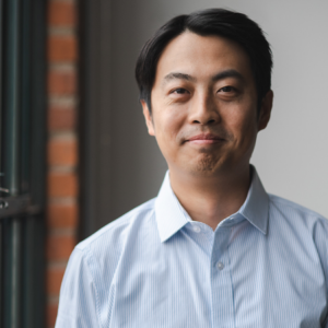
Ge (Jeff) Pu, Ph.D.
Cleveland Water Alliance
Abstract
Cleveland Water Alliance (CWA) has established the Lake Erie Watershed as the largest digitally connected freshwater body in the world. Outfitted with over 6,500 square miles of telecommunications network and 200 smart sensors, the Smart Lake Erie Watershed houses Accelerator Testbeds that deploy exciting, cutting-edge IoT innovations from around the world. These Accelerator Testbeds enable innovators to test, trial, and demonstrate their technologies within a variety of real-world environments, and can support curated pilots with potential buyers and end-users. Providing for legal and insurance considerations, CWA hosts innovators of all sizes – from start-ups, small and to mid-sized companies, to multinational, brand-name corporations – and supports technologies throughout the IoT lifecycle, from sensors to gateway extenders to anti-biofouling equipment and beyond. There have been over 60 deployments launched or scheduled in the Accelerator Testbeds to date, making CWA and the Smart Lake Erie Watershed a destination and springboard for international companies seeking to enter the US market.
Biography
Jeff Pu is a postdoctoral research fellow dedicated to understanding water resource issues. His work so far has focused on integrating and deploying various innovative water resource sensors to understand environmental issues (i.e., Flooding, Erosion, and Harmful Algal Blooms) around Lake Erie.
His research has been jointly funded through Cleveland Water Alliance, LimnoTech, and NOAA CIGLR. You can find his work on various sensors around the Lake Erie region on YouTube, Twitter, and Engineering Blog. He hopes to share his findings with diverse stakeholders and contribute to ongoing efforts to protect Great Lakes’ water resources.
Jeff obtained his PhD in Water Resource Engineering from the State University of New York – College of Environmental Science and Forestry and MS and BS in Environmental Engineering from Drexel University.
NSF’s Technology, Innovation, and Partnerships (TIP) Convergence Accelerator programs relevant to water observing technologies.
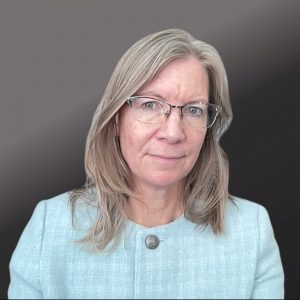
Catherine O’Reilly
National Science Foundation
Abstract
During this presentation Dr. O’Reilly will provide an overview of the National Science Foundation with a special focus on the Technology, Innovation, and Partnerships (TIP) Directorate and programs relevant to water observing technologies including funding for innovation ecosystems, technology, and workforce. Dr. O’Reilly will highlight specific examples recent funding for innovative solutions to water related issues through NSF’s Convergence Accelerator program.
Biography
During this presentation Dr. O’Reilly will provide an overview of the National Science Foundation with a special focus on the Technology, Innovation, and Partnerships (TIP) Directorate and programs relevant to water observing technologies including funding for innovation ecosystems, technology, and workforce. Dr. O’Reilly will highlight specific examples recent funding for innovative solutions to water related issues through NSF’s Convergence Accelerator program.
Abstract
Learn about the key mechanisms and tools to partner with the U.S. Geological Survey. In addition, speaker will discuss and answer questions about common issues and obstacles that can occur in the partnership lifecycle.
Biography
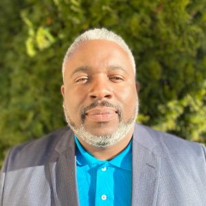
James Mitchell is the Patent and Licensing Manager for the U.S. Geological Survey (USGS). During his tenure with the USGS, he has received several national awards for his technology transfer efforts. James is a former U.S Patent and Trademark Office Supervisory Patent Examiner, educator and American Federation of Teacher Union Representative. He holds a B.S. in Physics, Juris Doctor and is a registered Patent Attorney.
Innovative Solutions for Water and Power: Reclamation Prize Competitions, Research, and Technology Transfer
Christine VanZomeren
Bureau of Reclamation

Abstract
Innovating through research and development (R&D) advances Bureaus of Reclamation’s (Reclamation) mission to manage, develop, and protect water and related resources in an environmentally and economically sound manner. Reclamation’s R&D Office addresses difficult technical challenges in water availability, infrastructure, and the environment resulting in tools and capabilities Reclamation and western water managers use today. Reclamation offers research and development opportunities through the Science and Technology (S&T) Research and Prize Competition Programs to address technical obstacles and meet Reclamation’s mission. The Research Program annually prioritizes Reclamation research gaps and emerging needs that required innovation, and typically invests in ~25 new innovative research projects per year. Prize competitions engage with non-traditional researchers through crowdsourcing, and often complements traditional research paths such as the S&T Program. Reclamation has launched 34 competitions and awarded over $6.5M for winning solutions since 2014. In 2023, the R&D Office Introduced the Facilitated Adoption Program, which supports the transition of promising research and prize outcomes into practice. Related, the R&D Office supports technology transfer through publications, workshops, demonstrations, partnerships, patents/licenses, or and other technology transfer agreements to ensure research is effectively disseminated and integrated into practice. Key to the success of spurring innovation and meeting Reclamation’s mission is partnering with Federal and non-Federal partners. On-going S&T Research projects and Prize Competitions, as well as potential upcoming topics related to water observing, will be described.
Biography
Dr. Christine VanZomeren joined Bureau of Reclamation in February 2024 as the Prize Competition Program Administrator. Dr. VanZomeren is responsible for administering a portfolio of prize competitions and technology searches related to water availability, infrastructure sustainability, and the environment. This includes developing partnerships with Federal and non-Federal agencies to enhance prize competition activities and coordinate efforts to develop prize competition solutions that benefit Reclamation and the water resources management community. Dr. VanZomeren spent the last nine years in aquatic ecosystem restoration research and program management at the U.S. Engineer Research and Development Center before joining Bureau of Reclamation this year.
Collaborating & Contracting with the U.S. Army ERDC
Lynn Zanow
U.S. Army Engineer Research and Development Center (ERDC)

Abstract
The U.S. Army Engineer Research and Development Center (ERDC) is the premier research and development center for the U.S. Army Corps of Engineers. We discover, develop, and deliver innovative solutions to the nation’s toughest challenges in military engineering, installations and operational environments, civil works, geospatial research and engineering, and engineered resilient systems. Learn more about ERDC and explore our missions.
Biography
Lynn Zanow serves as a Technology Transfer Officer, providing sound business practices, policy, and guidelines for the Army Corps of Engineers, Engineer Research Development Center Technology Transfer program; Mr. Zanow facilitates the transfer of technology, science, intellectual property, processes and products to our government, industry, and academic partners; in addition, he serves as the program manager for ERDC’s Partnership Intermediary.
Abstract
ERDCWERX, an innovation hub of DEFENSEWERX, provides a streamlined path to collaboration and contracting with ERDC. ERDCWERX events, tech challenges, and other opportunities make it easier and faster for innovators to propose solutions for consideration by ERDC. As a result of ERDCWERX’s partnership with ERDC, a growing number of contracts and agreements are being awarded to industry and academia.
Biography
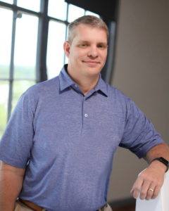
As Senior Innovation Project Manager at ERDCWERX, Billy Klauser oversees the investigation, design, and implementation of ERDCWERX projects and other technology transfer and transition initiatives in support of ERDC innovation and commercialization.
Klauser is a business and economic development professional with over 30 years of experience in cultivating public-private partnerships for technology growth and innovation. Past projects include aviation and aerospace industry partnerships, unmanned aircraft systems (UAS) research initiatives, and technology advancement for economic development. Klauser has extensive experience in international trade, business intelligence, project management, and governmental relations.
Prior to joining ERDCWERX, Klauser served as the Deputy Director of the Alliance for System Safety of UAS through Research Excellence (ASSURE) and worked in the Office of Research and Economic Development at Mississippi State University, where he holds a bachelor’s degree.
